
スクリーンショット
説明
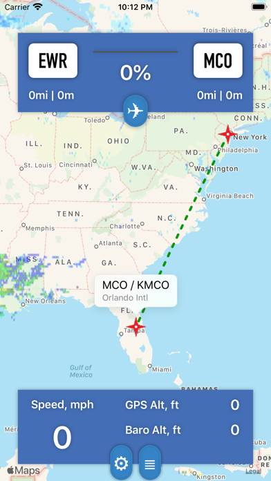
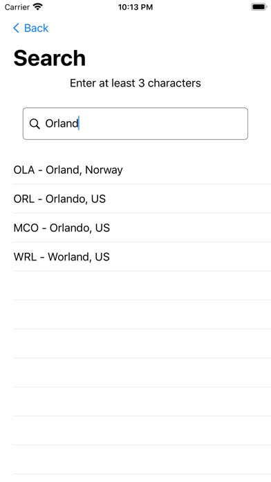
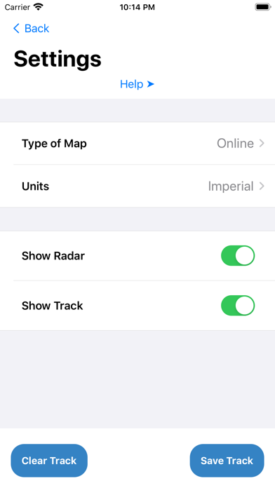
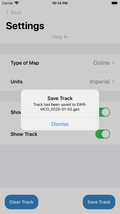
This app is intended for airline passengers who wants to see precise position of airplane on moving map in-flight. It does not require Internet connection to operate and indicates following flight parameters: * Ground speed (mph or km/h) * Altitude measured by GPS (ft or m) * Barometric altitude i.e. altitude associated with air pressure inside the cabin (ft or m) if supported by iOS device * Distance from departure / to destination airports (mi or km) * Time since departure (after takeoff detected) and to destination (calculated) While offline operation is primary use case an Internet access adding weather information for selected origin/destination, access to list of flights on FlightAware web site, weather radar and more detailed online maps. Recorded track can be exported in popular GPX format for review in Google Earth or similar geo applications later on. Imperial and metric units are both supported. It is also possible to make a text notes during the flight and review them later on. Notes are injected into the exported GPX file or can be exported separately as TXT file. More and more airlines prefer not to install seatback IFE on airplanes. That's causing lack of awareness important for many passengers. This app is trying to fix it using latest technologies available on iPhones. Few additional facts: * In order to work properly app requires access to internal GPS. * Window seat is highly recommended. * It may take 30-60 seconds to get initial GPS fix. * Time since departure is most precise if app running while airplane taking off. At that time iPhone should be in airplane mode.
新機能
バージョン 1.6 · 2026/3/7* Fixed weather radar
情報
- 販売元
- Nikolay Klimchuk
- カテゴリ
- Travel
- バージョン
- 1.6
- 対応OS
- iOS 15.6+
- サイズ
- 176.3 MB
- 年齢制限
- 4+