
スクリーンショット

説明
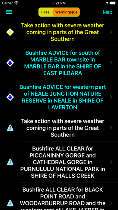
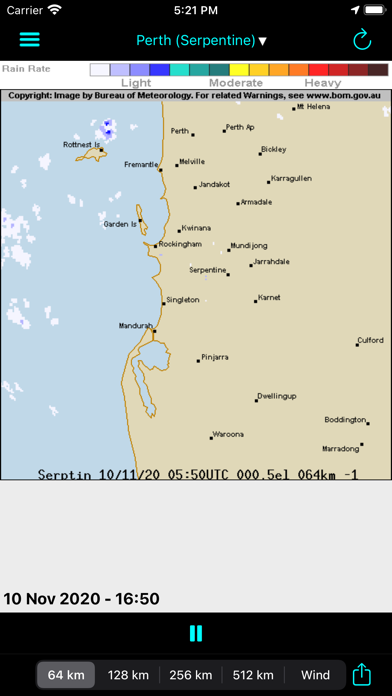
This application is designed to provide up to date information about bush fire data in Western Australia, for iPhone and iPad users. It utilises data from the Department of Fire and Emergency Services (WA) data feeds on fires, wind data from the Bureau of Meteorology with your current location provided by the iPhone GPS. Using this information the application is able to provide a list of fires showing the nearest ones first, helping you to understand your current situation. The information is reliant on both the accuracy of the iPhone GPS and the data recorded on the DFES website. This application does not cache any fire data, so Internet access (either Wireless. 3G or GPRS) is required to access the data. Be aware that while P4G has utilised "best efforts" to provide this information to you, it is not intended to replace other sources of information on the fire situation near you. Also remember that fire and weather can change quickly. © Government of Western Australia (Department of Fire and Emergency Services). For current information go to www.emergency.wa.gov.au Follow P4G on twitter at P4G_Apps
新機能
バージョン 2.2 · 2025/12/26Some minor changes to the user interface to make it look better with iOS 26. Also includes the ability to send the incident location to ForeFlight.
情報
- 販売元
- P4G Pty Ltd
- カテゴリ
- News
- バージョン
- 2.2
- 対応OS
- iOS 13.0+
- サイズ
- 29.9 MB
- 年齢制限
- 4+